-

John Speed's 1610 Map of Munster (Enlarged)

1
/
of
1
The Walton Collection
John Speed's 1610 Map of Munster (Enlarged)
John Speed's 1610 Map of Munster (Enlarged)
Regular price
€245,00 EUR
Regular price
€245,00 EUR
Sale price
€245,00 EUR
Unit price
/
per
Tax included.
Shipping calculated at checkout.
Couldn't load pickup availability
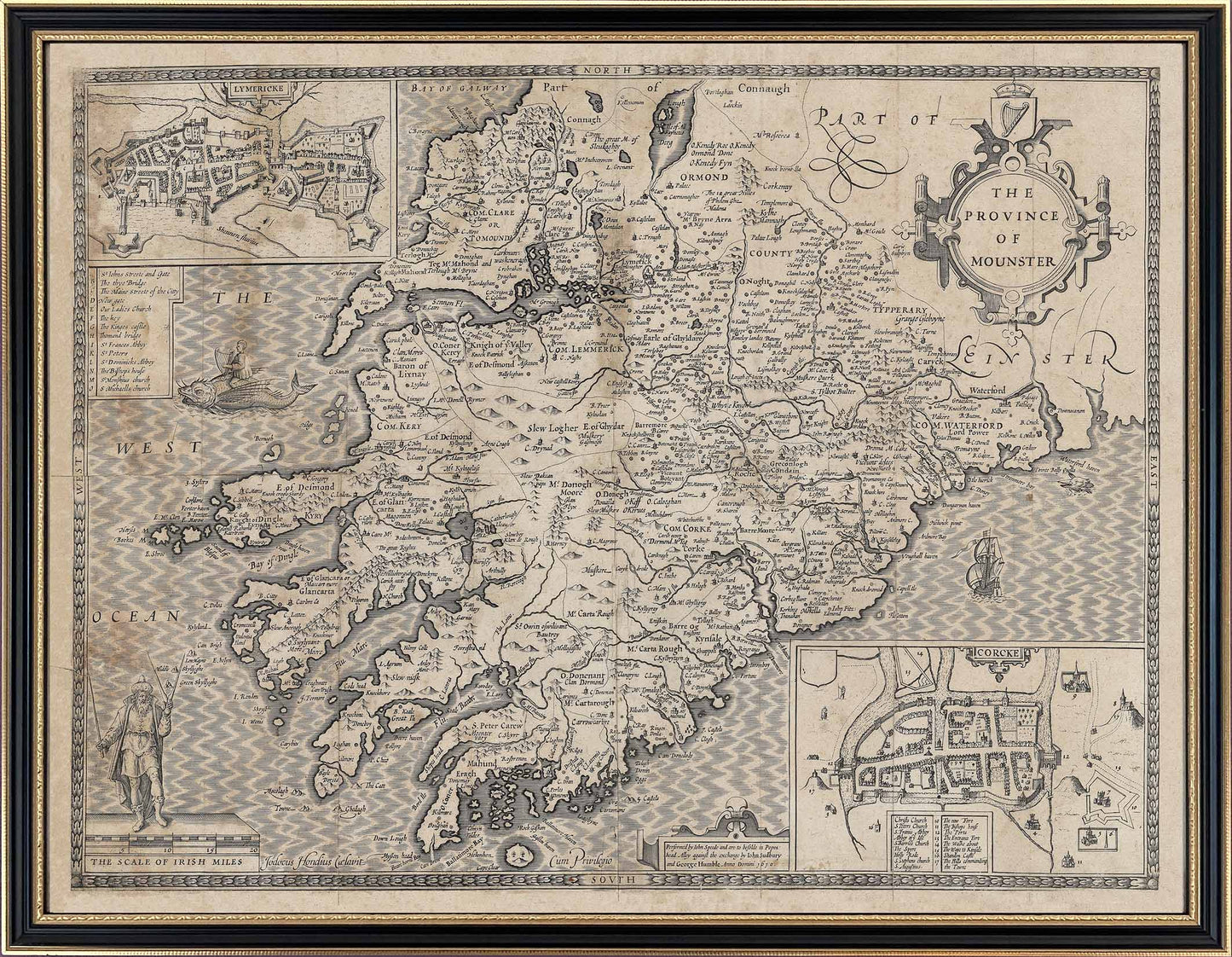
"The Province of Mounster" with inset maps of "Lymericke" and"Corcke", each with key buildings either lettered or numbered and listed in an index makes interesting reading. Stretching from The "Bay of Galway" down to "Cape Clear" the west coast is clearly less populated or defined, suggesting that many parts of Munster were less colonised or known. Ireland and both Cork and Limerick are clearly well-protected castle towns suggesting some enemies living outside the walls!
Enlarged to 690mm x 540mm for ease of reading each map is beautifully reproduced to be almost indistinguishable from the originals and framed in a fine period Hogarth frame
Share