-

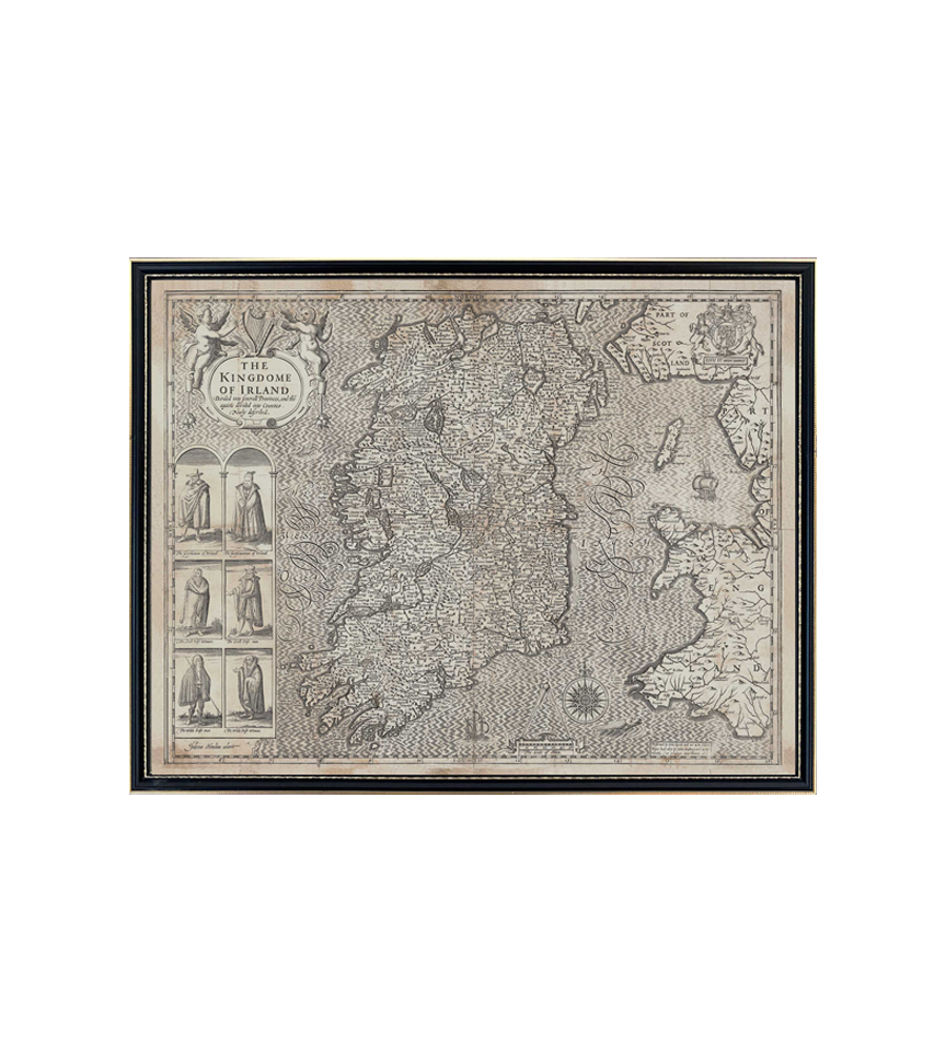
John Speed's 1610 Map of Ireland (Original size)

The Walton Collection
John Speed's 1610 Map of Ireland (Original size)
John Speed's 1610 Map of Ireland (Original size)
Couldn't load pickup availability
John Speeds Maps of Ireland and the Provinces of Ireland c.1610
A thoroughly English man and proud of it his maps of Ireland these maps were published in London as part of a collection known as the Theatre of the empire of Great Britaine . According to a paper published in 1978 by J.H. Andrews in the Irish Heritage series (Volume 18):
“Much as Speeds raw material derives from surveys by two brave cartographers – Robert Lythe in c.1570 and Francis Jobson in c. 1590 – whose work was never published under their own names. And there were several other Elizabethan map makers whom speed ignored but who probably knew a good deal more about Ireland than he did. At least two of them were killed by the people whose lands they had been surveying. For these men too were foreigners, employed by a foreign government. Yet they were also Irish in a sense denied to copyists like Speed. His Theatre, for all its merits, resembles many other great atlases of the past in making every landscape look the same – an abstract network of towns, villages and territorial boundaries dotted with conical hills. . Cartographers who actually saw the Ireland of Elizabeth or James 1, though usually inferior in artistic technique, often achieved a clearer impression of reality, conveying a recognisable likeness of the midland bogs, and esker ridges, …or if the scale was large enough of the raths and crannogs that still survived in considerable numbers further north….”
Not withstanding the above this is one of the few sets of maps that have survived from the period and laid the groudwork for future improvements so are very important insights into Elizabthen thinking of the time including all its its classic prejudices with inset illustrations on the map of Ireland of both the “The Wild Irishman” and “ The Wild Irish Woman”.
Beautifully reproduced in its original size, each map is beautifully reproduced in a fine period Hogarth frame to be almost indistinguishable from the originals and are available invidually in their original size (550mmx 430mm) or an enlarged version (690mm x 540mm). A Limited Edition (250) set of the complete of 5 maps (Ireland and the 4 provinces) are also available in both original and enlarged size.
Share