Beautiful reproduction of Rocques detailed and rare An Actual Survey of County Dublin on the same scale as those of Middlesex, Oxford, Barks and Buckinghamshire first published in 1760. Rocque (c.1704 -1762) was from a French Huguenot family that fled persecution to Geneva and later to England sometime after 1709. His 24 sheet map of London in published in 1746 established is fame and reputation as a the leading cartographer of the day.
He spent 6 years in Ireland where he produced several remarkable maps of Dublin, Armagh County, Kilkenny, Thurles and Cork, before returning to London in 1760. His Dublin survey built and improved on the previous Dublin maps of Speed (1611) , Brooking (1728) and Price (1730) . It was said that his Exact Survey of the city and Suburbs of Dublin deferred to the estate-map tradition by being minute enough for landowners to colour their own properties. Rocque's work, along with that of Bernard Scalé, almost single handedly elevated the concept of Estate Mapping from the agents office into the drawing rooms and libraries of the gentry where the maps took their place among the furniture and other works of art as an fine example of Georgian craftsmanship and taste.
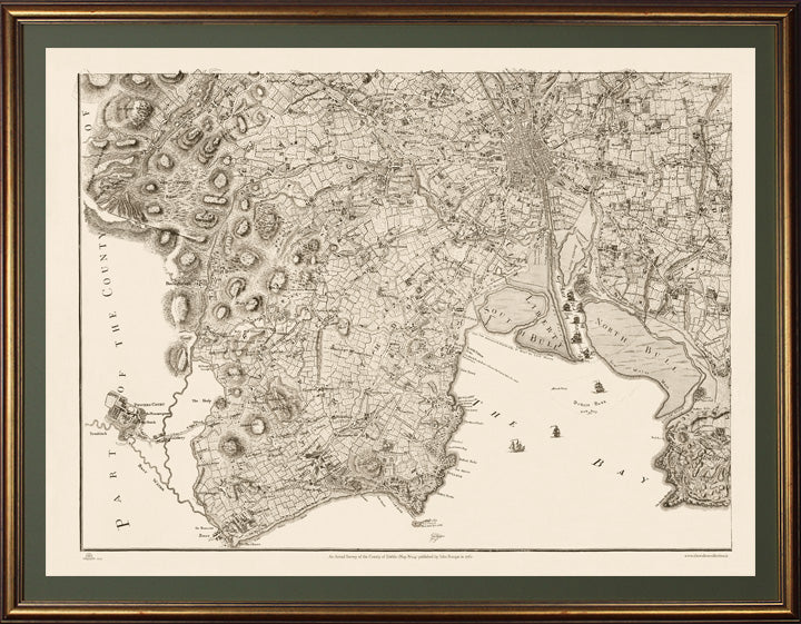
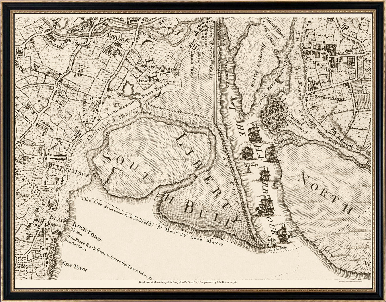
There are four maps in the series with Maps 1,2 & 4 currently available from The Walton Collection. This Map No.4 covers the Southeast quadrant of the County to the boarder with Wicklow including the City of Dublin, Dublin Bay, North Bull, South Bull, "Dun Lary", and Dalkey to Bray, Dublin Mountains, and indeed the fabulous Powersourt House and Gardens which was deemed worthy of inclusion. A close-up detail (inset below) shows the entrance to Dublin Port between the continually silting North and South Bull sandbanks (on which many ships floundered), and shows the original shorter South Wall and "The Piles" which had been built to counter silting in 1731. "The Piles" eventually failed and were replaced by the new stone Great South Wall in existence today which was built from the light tower (now Poolbeg lighthouse) to the shore. This work commenced in 1761 by shipping huge granite stones from quarries in Dalkey and was completed in 1795. It was the world's longest sea wall at the time of its construction and remains one of the longest in Europe.
Each map is reproduced perfectly on the same scale as the original set behind glass on pale 'palm green' mountboard in an 'Aged gold leaf' frame.
Customisation close-ups of areas within this map are available in smaller frames from €250 similar to example shown below. For customisations of your townland or parish from this map phone +353 (0)86 2608225 or email info@thewaltoncollection.ie