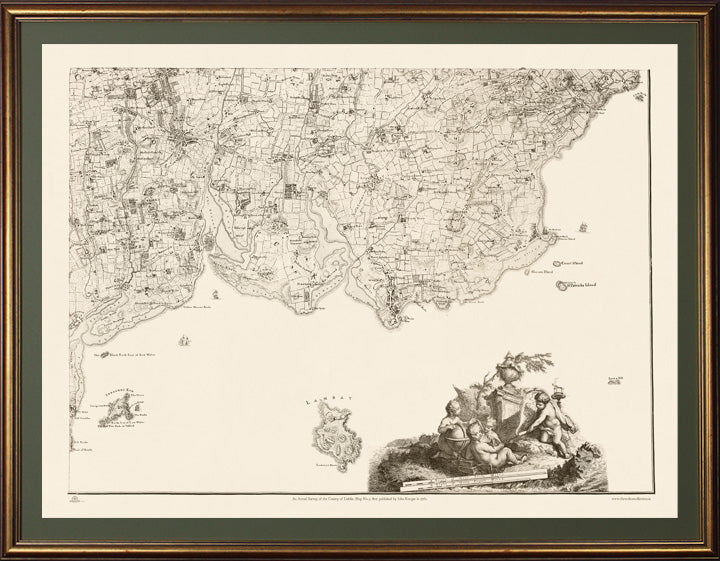
Beautiful reproduction of Rocques detailed and rare An Actual Survey of County Dublin on the same scale as those of Middlesex, Oxford, Barks and Buckinghamshire first published in 1760. Rocque (c.1704 -1762) was from a French Huguenot family that fled persecution to Geneva and later to England sometime after 1709. His 24 sheet map of London in published in 1746 established is fame and reputation as a the leading cartographer of the day.
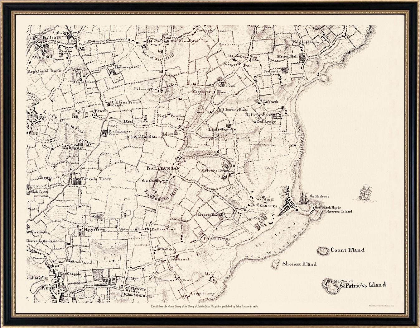
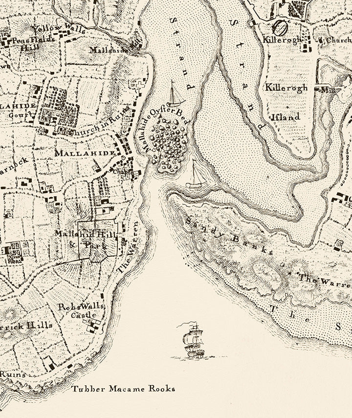
He spent 6 years in Ireland where he produced several remarkable maps of Dublin, Armagh County, Kilkenny, Thurles and Cork, before returning to London in 1760. His Dublin survey built and improved on the previous Dublin maps of Speed (1611) , Brooking (1728) and Price (1730) . It was said that his Exact Survey of the city and Suburbs of Dublin deferred to the estate-map tradition by being minute enough for landowners to colour their own properties. Rocque's work, along with that of Bernard Scalé, almost single handedly elevated the concept of Estate Mapping from the agents office into the drawing rooms and libraries of the gentry where the maps took their place among the furniture and other works of art as an fine example of Georgian craftsmanship and taste. There are four maps in the series with Maps 1,2 & 4 currently available from The Walton Collection. This Map No.3 covers the Northeast quadrant of the County including Baldoyle, Coolock, Malahide, Swords, Donabate, Portrane, Rush, Skerries Balbriggan, Lambay and Irelands Eye. A close-up detail of Malahide and the estuary is inset below clearly showing where the "Malahide Oyster Beds" resided long before the railway bridge across the estuary was built.
Each map is reproduced perfectly on the same scale as the original and set behind glass with an 'Aged gold leaf' frame.
Customisation close-ups of areas within this map are available in smaller Hogarth style frames from €250 similar to the example of Skerries shown below. For customisations of your townland or parish in this map phone +353 (0)86 2608225 or email info@thewaltoncollection.ie