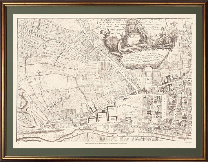
Beautiful reproduction of Rocques detailed An Exact Survey of the City and Suburbs of Dublin first published in map on a scale of 200ft to 1 inch in 1756 . Rocque (c.1704 -1762) was from a French Huguenot family that fled persecution to Geneva and later to England sometime after 1709. His 24 sheet map of London in published in 1746 establised is fame and reputation as a the leading cartographer of the day.
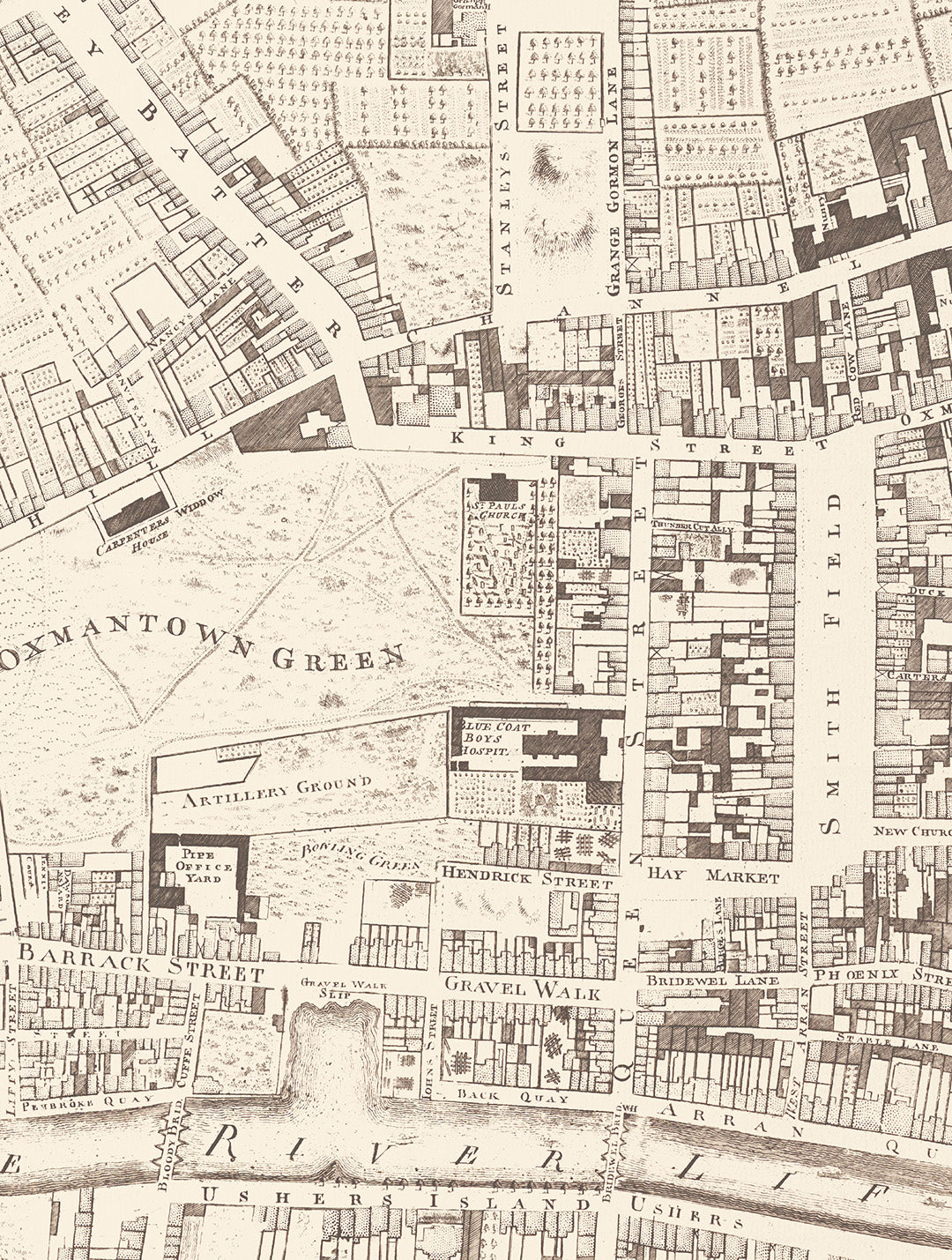
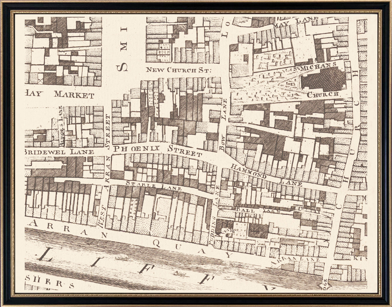
He spent 6 years in Ireland where he produced several remarkable maps of Dublin, Armagh County, Kilkenny, Thurles and Cork, before returning to London in 1760. His Dublin survey built and improved on the previous Dublin maps of Speed (1611) , Brooking (1728) and Price (1730): . It was said that this Exact Survey of the city and Suburbs of Dublin deferred to the estate-map tradition by being minute enough for landowners to colour their own properties. Rocque's work, along with that of Bernard Scalé, almost single handedly elevated the concept of Estate Mapping from the agents office into the drawing rooms and libraries of the gentry where the maps took their place among the funriture and other works of art as an fine example of Georgian craftsmanship and taste. This Map No.1 covers the North West City, The Phoenix Park, Cabra, Smithfield, Oxmantown, , "Royal Square" Barracks (now Collins Barracks) and Usher's Island.
Each map is reproduced perfectly on the same scale as the original on pale 'Palm Green' mountboard set behind glass in an 'Aged gold leaf' frame.
Customisation close-ups of areas within this map are available in smaller frames from €250 similar to example shown below. For customisations of your townland, street or house from this map phone +353 (0)86 2608225 or email info@thewaltoncollection.ie