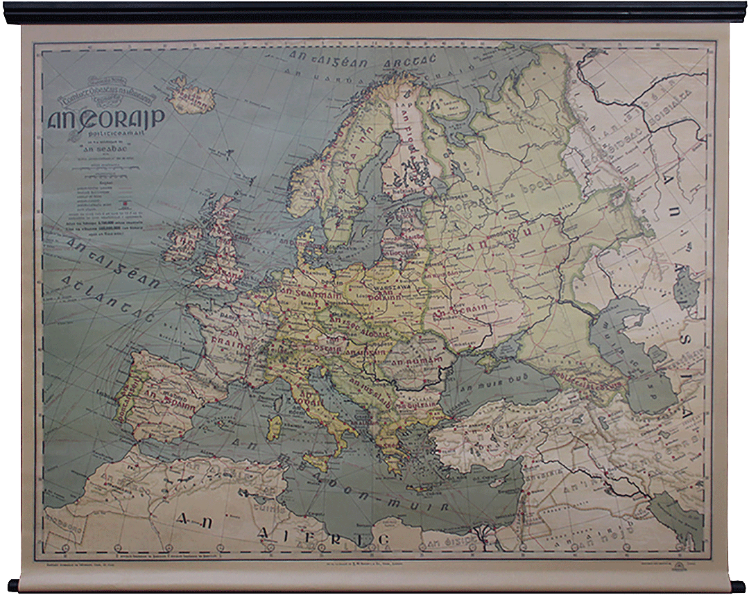
This very rare Irish-language school map of Europe, one of just two known surviving originals, appears to date back to the late 1920's or early 1930's at the latest. The cartographer was ‘An Seabhac’ , a pen name for Pádraig Ó Siochfhradha. This political map of Europe was printed by G.W Bacon & Co. Ltd. in London and provided by Comhlucht Oideachais na hÉireann as a learning tool for classrooms across the country during the inter-war period.
The map, on a scale of 1 inch to 68 miles, gives scale in both miles and kilometres, providing scale-to-size guides as well as a map key outlining the main railroads/networks, steamboat routes, undersea cables, capital & major cities and river lengths. The ornamental clocks at the base of the map shows what time of day it is at the longitudinal lines when it is midday at Greenwich. At the original time of print, the combined population of Europe and Russia was 550m but stands at 890m today.
This unique map allows us to consider political Europe after WWI, yet before the colossal upheaval evoked by WWII, the Cold War and the fall of the USSR, and post colonial developments in the Middle East since the 1950's. It affords us a moment in time, as well as the intriguing linguistic insight into pre-standardised Irish.There are a multitude of notable political and linguistic aspects to this map that indicate the period in which it was crafted and will provide many talking points:
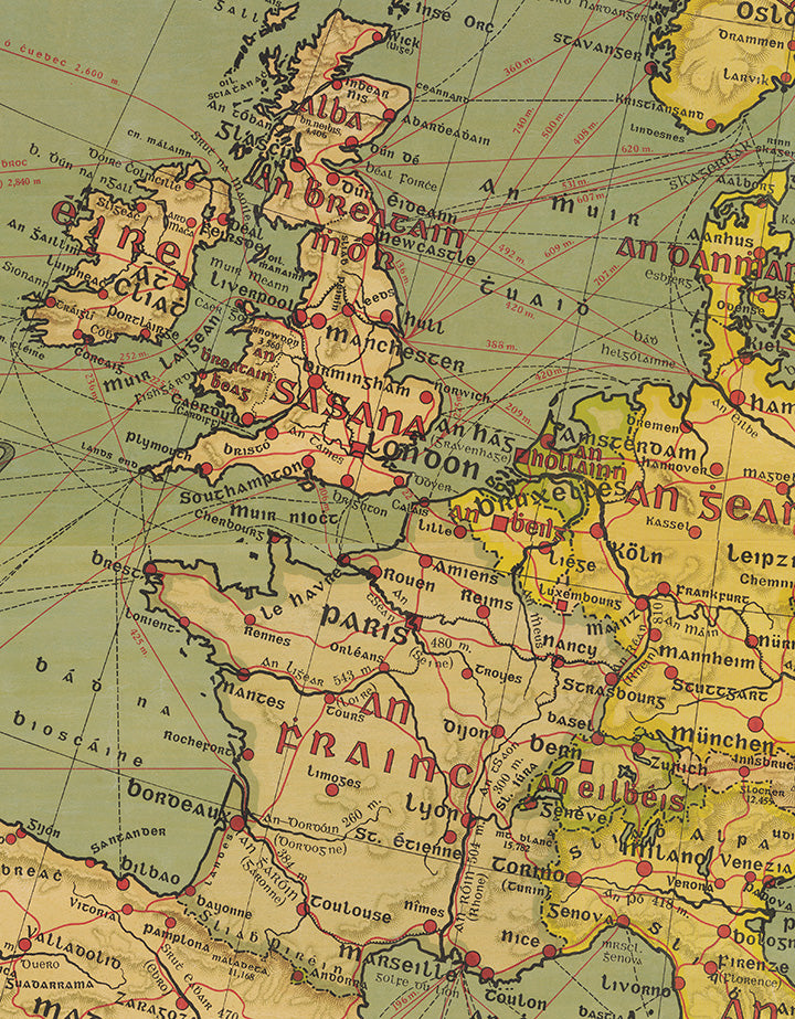
Éire is not recognised as being partitioned. Partition occurred in 1921, however due to the overall portrayal of Europe in this map we can ascertain that those involved did not recognise the border between Northern Ireland and the Free State.
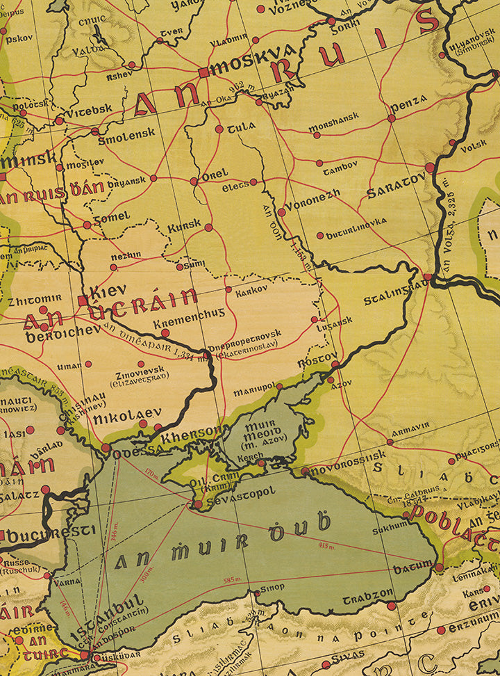
An tSec-Shlobhaic [an tSeicslóvaic],Czechoslavakia, created in 1918, appears in Central Europe. The same territory is now made up of Czech Republic and Slovakia. An Úcráin (Ukraine) is clearly shown, albeit as part of the former USSR. (see inset detail below)
An Iúg-Shlaibh [an Iúgslaiv], Yugoslavia, also formed in 1918, appears in the same region now made up of Croatia, Montenegro, Serbia, Slovenia, Bosnia and Herzegovina, and Macedonia.
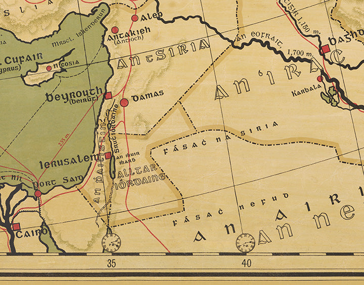
An Phailistín (Palestine) is clearly shown where the state of Israel has largely since replaced it, while modern Lebanon does not exist, being part of An tSiria (Syria).(see inset detail below)
This wall-hanging map, which was collected by Martin Walton, is a remarkable and beautiful work by ‘An Seabhac’ and has been lovingly restored to its former glory to reproduce the political geography of the age through Irish. It is an exact size-replica of the original wall hanging and printed on high quality polycanvas with a black wooden mounting and dowel at the base, replicating the precise way it would have been hung in classrooms around Ireland. Please note the colour of the final print is better represented by the detail insets below.
For anyone with a love of the Irish language or geography it is a collectors item and exclusively available from The Walton Collection.